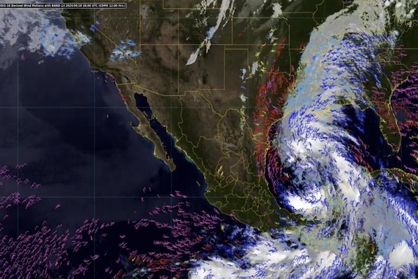
Tropical storm heading for Gulf of Mexico prompts FCDO travel alert
A tropical storm heading for the Gulf of Mexico has prompted a Foreign Office (FCDO) travel alert for Mexico, and could hit the country later this week.
The FCDO has warned travellers the storm is heading towards the eastern coast of Mexico, and could potentially turn into a cyclone over Wednesday and Thursday (19-20 June) when it’s due to make landfall.
Forecasters say that if the winds gather enough force, the cyclone could turn into the first named storm of the Atlantic hurricane season, which would see it christened Tropical Storm Alberto.
The US National Hurricane Centre and the Mexican met office believe the storm will impact large parts of eastern Mexico, including the states of Yucatan, Veracruz and Oaxaca, as well as southern Texas.
“This rainfall will likely produce considerable flash and urban flooding along with new and renewed river flooding," said the US weather authority.
A large area of disturbed weather over the Gulf of Mexico has the potential to become the first tropical storm of the Atlantic season. Irrespective of storm formation, heavy rain and flooding are likely over parts of Texas and north-eastern Mexico over the next few days. pic.twitter.com/nv18vwybXb
— Met Office Storms (@metofficestorms) June 18, 2024
“Life-threatening flooding and mudslides are likely in areas of higher terrain across the states of Coahuila and Nuevo Leon, including the city of Monterrey.”
Mexican officials have urged people to take “extreme precautions” against the wind, rain and wave conditions as well as follow the advice of local authorities.


